 Polar Projection
Polar Projection
Polar Projection
Visualizing orbits has always been a challenge for me. Most tracking programs use an equirectangular projection which is by far the easiest to program and shows the entire earth at once. A 3D model is often used which helps visualize orbits but does not show the entire earth at the same time. I remember having an easier time visualizing the orbits back in the day when we used Oscar Locators. Andy Thomas G0SFJ has a great web page for a vintage Russian geostationary satellite locator he was fortunate enough to buy at a flea market. I modified a program of mine to use the old school Russian IMMARSAT map as the basis for a polar projection satellite tracker.
I am sure there are many other programs out there that do the same thing. Here are a few screen shots from yet another one. Even though the continents look a little funky the tracks actually came out quite close to SatPC32 tracks. It does take a little while to get used to the new look of the world. It is an equiangular projection so as you get farther away from the north pole things look larger. Who knew Australia was so large.
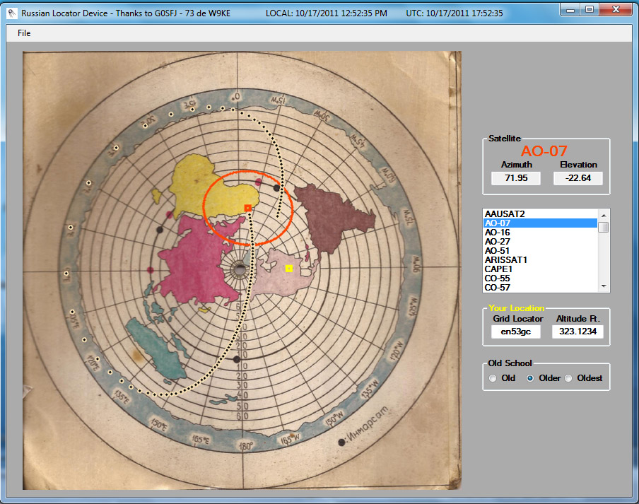
---- AO-7 over North Africa. Yes, that yellow blob is Africa. ----
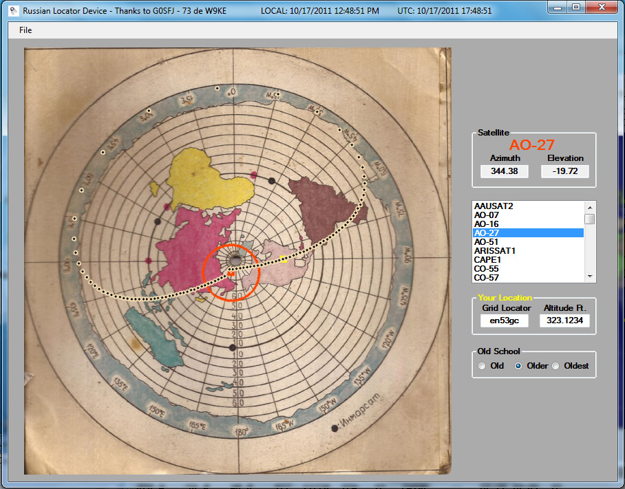
---- AO-27 near the North Pole ----
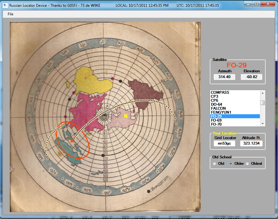
---- FO-29 possibly near East Timor ----
My qth EN53gc is shown as the yellow square on the map is in Wisconsin (+ 43 degrees latitude) and is north of the southern end of Lake Michigan. It came out quite close to the latitude scale on the map but the great lakes are shown way too far north. Things like this add to the charm of this great map.
You might want to try and find your qth on the map. Use the latitude and longitude scales on the map and see where it comes out on the the land mass. The longitude numbers are hard to read on the left side of the map. Not sure if it is due to a poor printing job or the map was not flat during digitizing. The longitude marks are every 15 degrees so it is not hard to figure out.
73 de W9KE